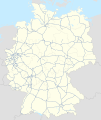
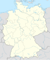
Fail:Germany location map 23 April 1949 - 22 May 1949.svg
Bikpela piksa (SVG file, nominally 1,075 × 1,273 pixels, file size: 1.13 MB)
This file is from Wikimedia Commons and may be used by other projects. The description on its file description page there is shown below.
Liklik toksave bilong senis
DescriptionGermany location map 23 April 1949 - 22 May 1949.svg |
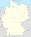
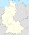
Deutsch: Positionskarte (West- und Mittel-) Deutschlands. Diese Karte zeigt den Gebietsstand zwischen 23. April_1949 bis 22. May 1949.
Quadratische Plattkarte, N-S-Streckung 150 %. Geographische Begrenzung der Karte:
English: Location map of Germany. Map shows Germany as of April 23rd 1949 till May 22nd 1949.
Equirectangular projection, N/S stretching 150 %. Geographic limits of the map:
|
||
Date | Created in 2010 | ||
Source |
own work, based on: |
||
Author | TUBS | ||
Permission (Reusing this file) |
I, the copyright holder of this work, hereby publish it under the following licenses:
This file is licensed under the Creative Commons Attribution-Share Alike 3.0 Unported license.
You may select the license of your choice. |
||
Other versions |
Bundesrepublik Deutschland (vor 1990 nur West-Deutschland):
Deutsche Demokratische Republik (mit BRD im Ausschnitt):
Ostdeutschland (vor 1990 Deutsche Demokratische Republik):
Deutschland zwischen Mai 1945 und Oktober 1949:
Thematisch:
Deutsches Reich (1918–1945) (best used with this template (de)):
|
Items portrayed in this file
depicts Inglis
creator Inglis
some value
copyright status Inglis
copyrighted Inglis
data size Inglis
1,180,060 byte
height Inglis
1,273 pixel
width Inglis
1,075 pixel
media type Inglis
image/svg+xml
checksum Inglis
40715efd33b1a47012cac2b6971d7ace207fc010
Ol senis bilong dispela fail
Click on a date/time to view the file as it appeared at that time.
De/Taim | Liklik | Ol sais | Yusa | Tingting | |
---|---|---|---|---|---|
bilong nau | 07:30, 30 Epril 2010 | 1,075 × 1,273 (1.13 MB) | TUBS | == {{int:filedesc}} == {{Information |Description= {{de|Positionskarte (West- und Mittel-) Deutschlands. Diese Karte zeigt den Gebietsstand zwischen 23. April_1949 bis 22. May 1949.}} Quadratische Plattkarte, N-S-Streckung 150 %. Geogr |
Ol fail link
There are no pages that use this file.
Global file usage
The following other wikis use this file:
- Usage on de.wikipedia.org
- Usage on en.wikipedia.org
- Usage on ru.wikipedia.org